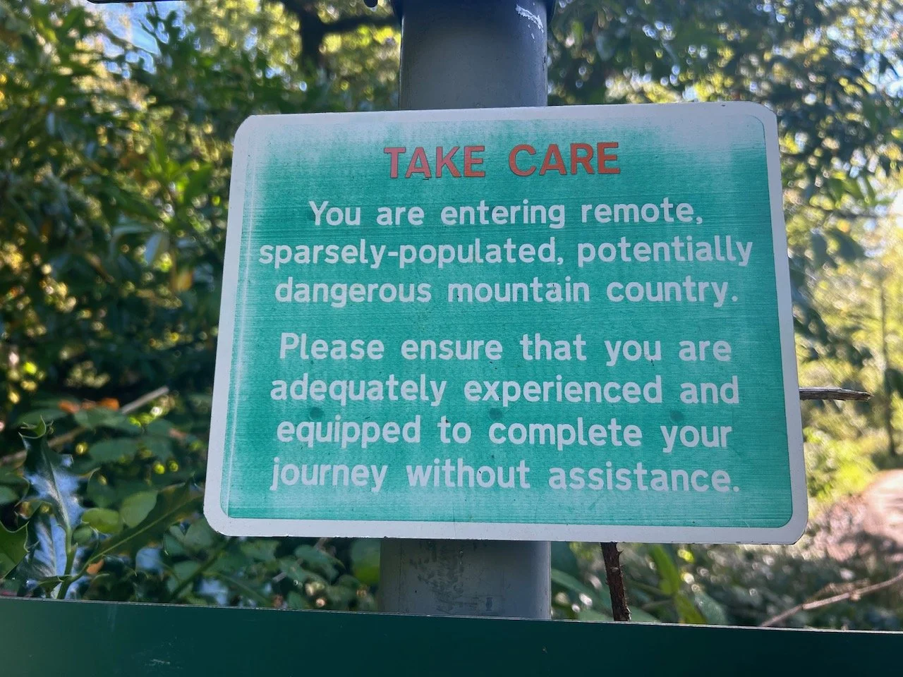
The Knoydart Wilderness one…
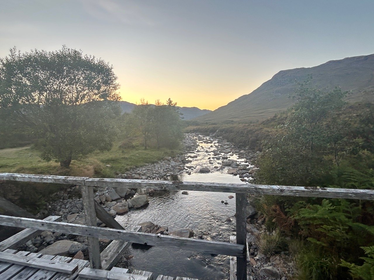
It’s 6am and there’s a heavy dew beneath our feet. The outlines of the mountains that surround us are becoming visible, though Ben Nevis is hiding, cloaked in cloud.
It’s a chilly 2 degrees and we’re against the clock, racing to pack up camp and rustle up breakfast. My hands are numb and I’ve lost all dexterity in my fingers, so much so I revert to using the plastic “spork” that Miles has brought along. This ends badly and I’m left picking coffee grounds out of my hair. At this point I’ve got the Jet boil spilling water everywhere, I cant find the mugs, and the parcel shelf where I’m attempting to do all of this is on the verge of collapse. Just as I get everything organised, we realise we’re late for the taxi and have to abandon the whole sorry saga. You never see this kind of camping faff on the TV…
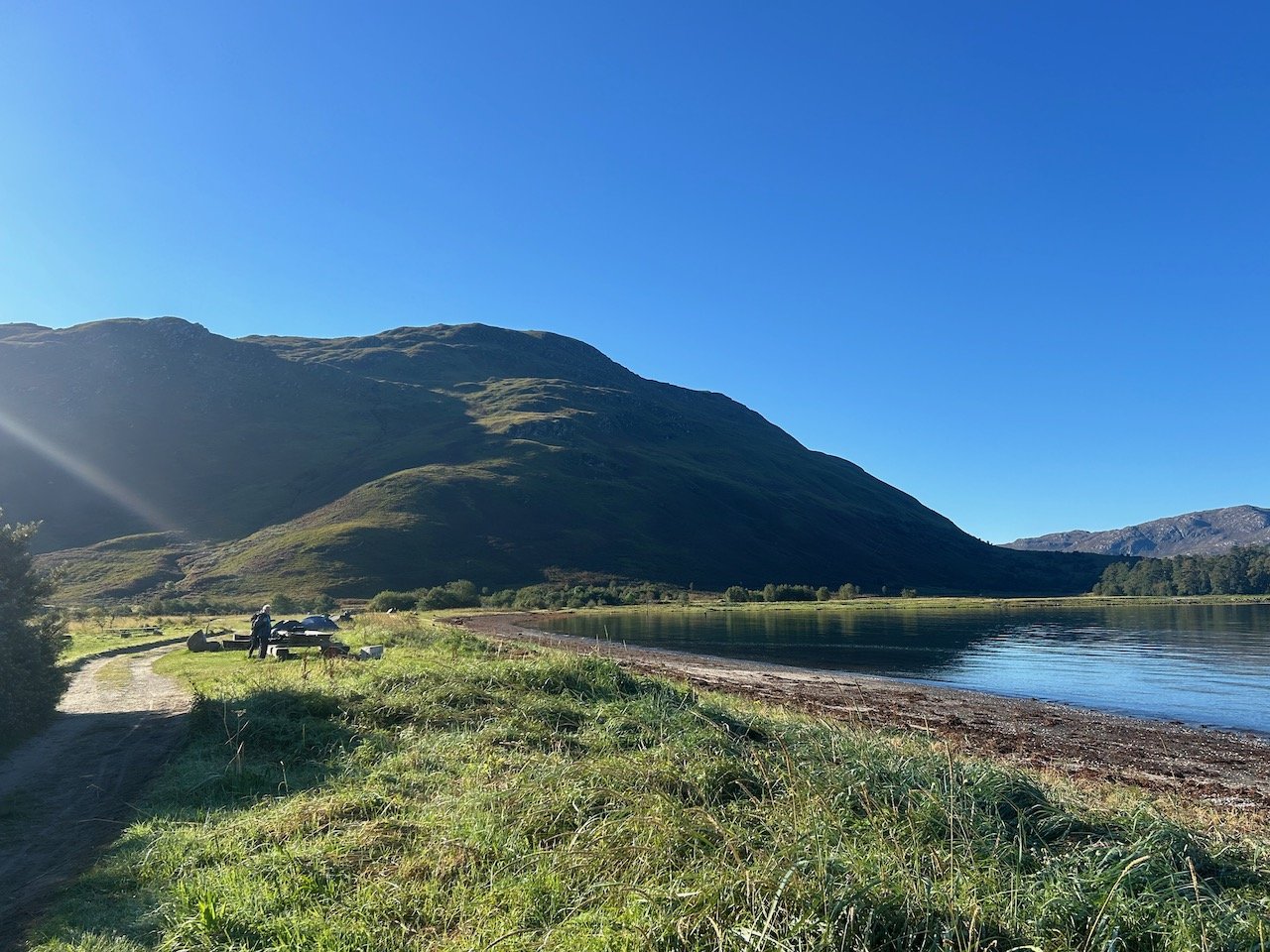
We’re late as we trundle through the campsite looking for our ride to the UK’s last remaining wilderness. We’re headed to the Knoydart peninsula; a place heralded for its untouched, remote beauty (and former UK holiday destination of a certain Sir Ranulph Fiennes). It’s a 2-ish hour taxi drive from Fort William; a town that should be so much nicer than it is. We’re aiming for Kinloch Hourn, our starting point for this adventure.
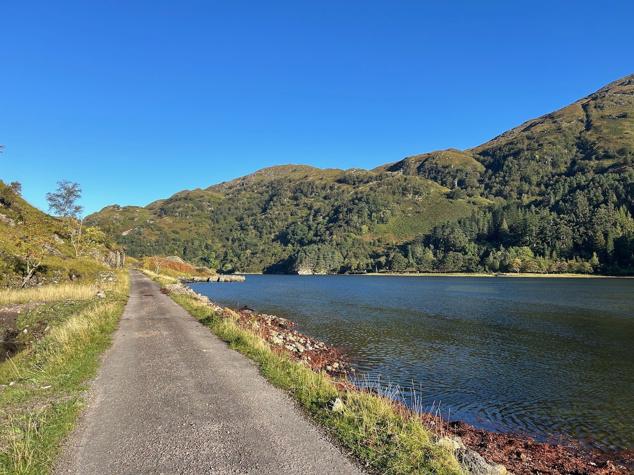
By 8am, we’re turning on to the longest no through road in Britain - a whopping 22 miles of narrow, bumpy and poorly maintained tarmac that arrives at a car park overlooking the beautiful Loch Beag. Despite it being paved, this is definitely a car killer road and proper 4 x 4 territory.
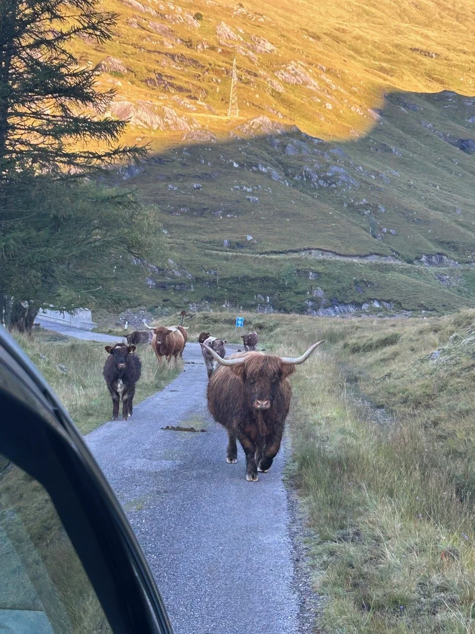
On route the cloud starts to lift, as a great loch appears on our left, and mountains appear in the middle distance. We turn a corner and slow to a stop as half a dozen highland cows march towards us. They’re in no great hurry as they pass the car, their horns inches from the wing mirrors of the car.
We’re already revelling in the remoteness of this wild place, staring out the window, full of excitement for the day’s adventure. It’s an odd feeling to have travelled so far through the fog and cloud to arrive into a car park, with a half dozen cars, B&B and cafe.
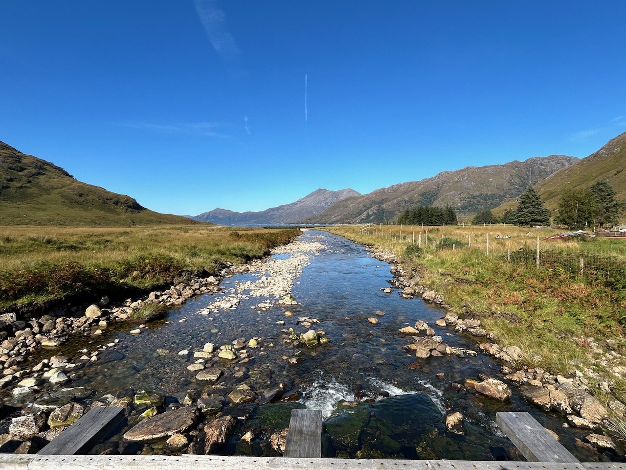
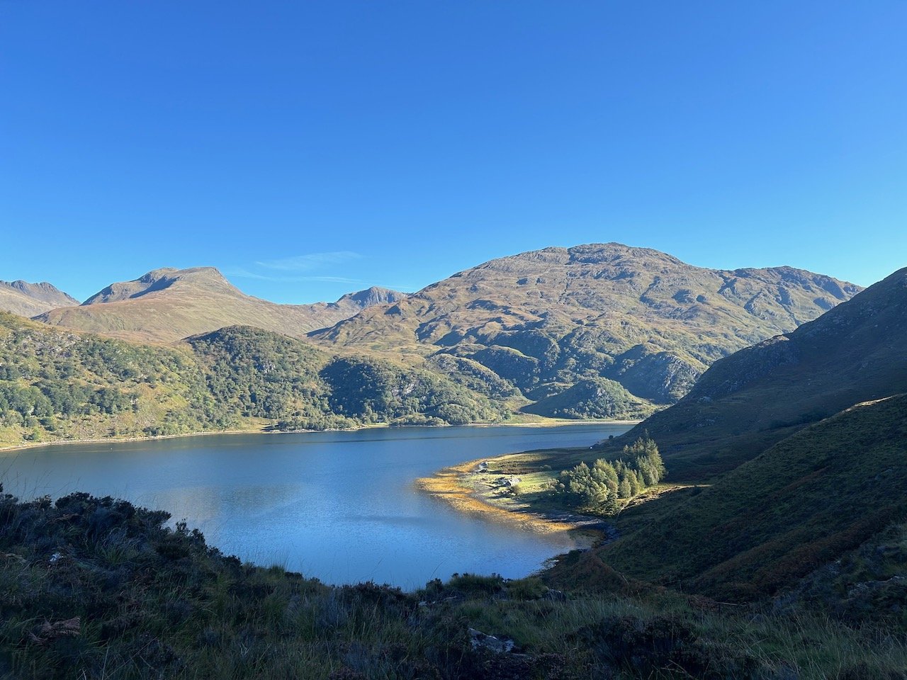
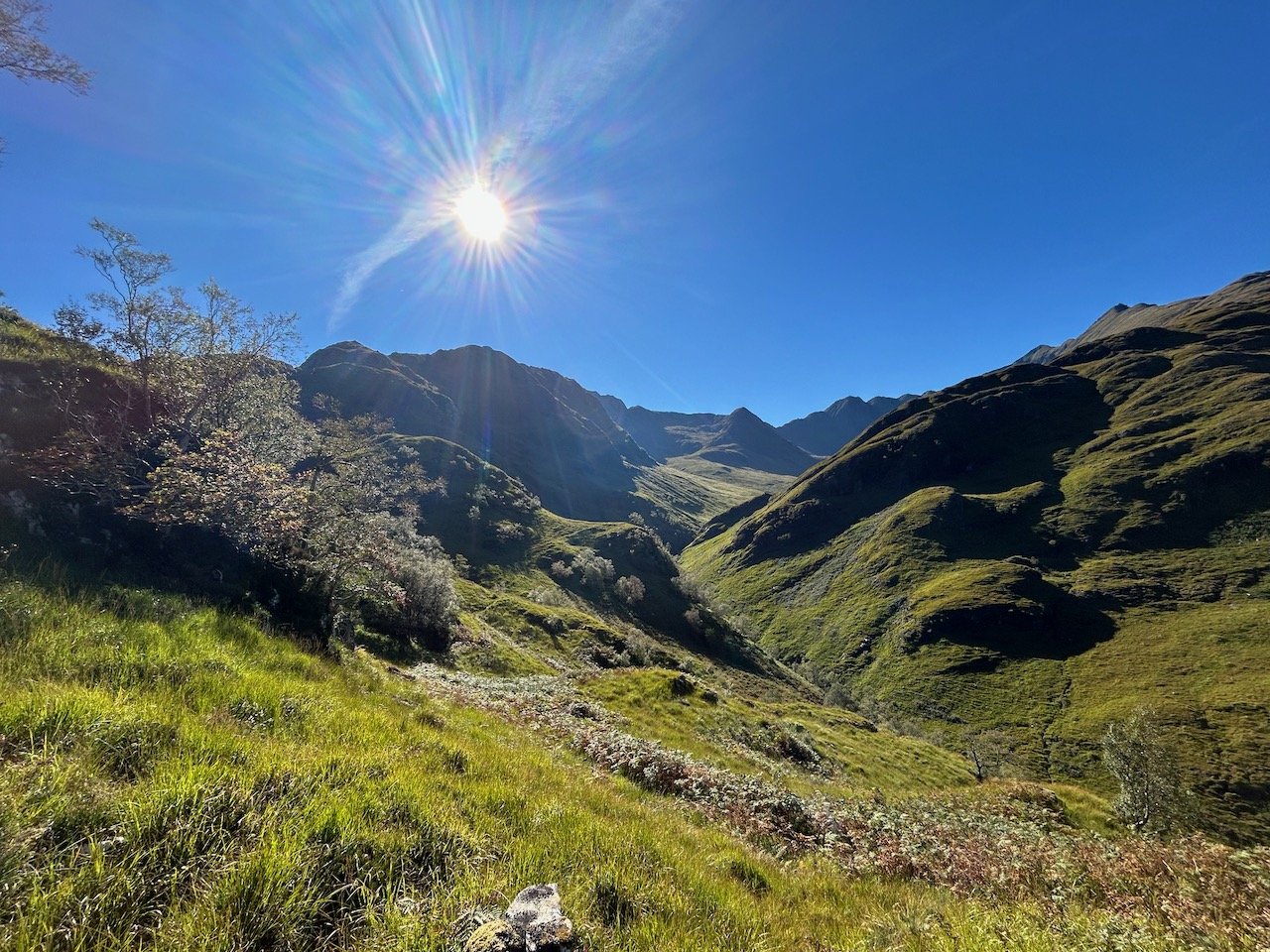
After a few minutes, and several repacks, we set off. It’s 8.45am and we’re contouring around the north, shadowy side of these mountains. There’s only one path so we follow it, as it hugs the great loch and gives us an incredible early morning view towards the distant peaks. There is an unmistakable sense of space and eerie quiet.
We quickly pass a couple of walkers coming in the other direction, and go on to meet 3 or 4 other small groups over the next hour or so. We guess they’ve stayed at the bothy, 3-4 hours walk from Kinloch Hourn and about half way to our final destination; Inverie.
The first few kilometres pass pretty uneventfully. It is however very, very boggy. We continue to walk in shadow for several hours and the morning chill lingers. We take it in turns to lead - no navigation is required and we spend most of the time wondering how on earth anyone could have ever, or indeed does still, live this remotely. This bemusement goes up a notch when we spot a small white cottage on the far side of the loch - we are hours from a main road, in fact we’re hours from any road, and the only access is via the loch itself.
It’s approaching late morning and we start to descend. As we turn a corner, we can see that the path leads down to a massive beach with what looks like a 4 x 4 track. Minutes later we arrive and find to our amazement that somehow there’s a well maintained track here complete with little storage shed. How on earth has that got here?
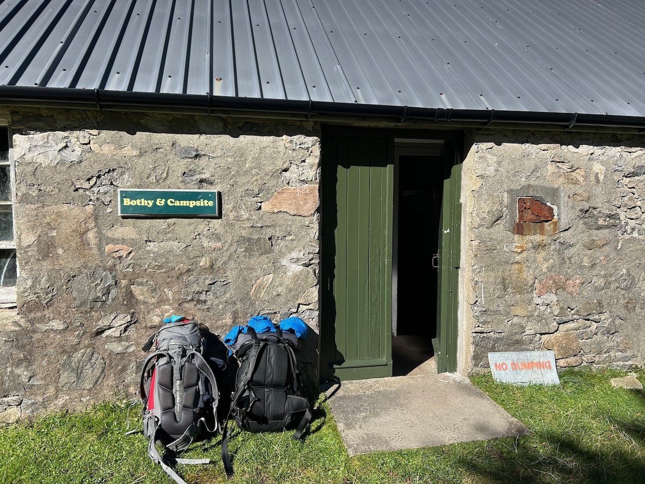
We trundle on knowing we’re not far from the bothy and a much deserved coffee stop. Only when we arrive it’s an underwhelming experience. The bothy was not at all as I / we had imagined, and dirty. Really dirty. Miles and I both agreed it would be best to go out and dig a hole than have to contend with sitting on the loo seat we are confronted with. We didn’t need to go, which was luckily as neither of us had bought a spade.
The place was deserted but not wild. In fact, it felt distinctly managed. There was a house, solar panels, several cars and a sheep enclosure. There’s even a building with a sign stating “office”. I love the idea that this is someone’s place of work.
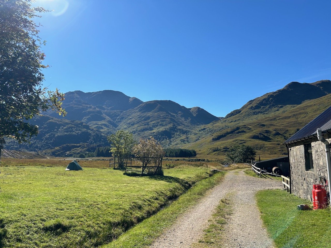
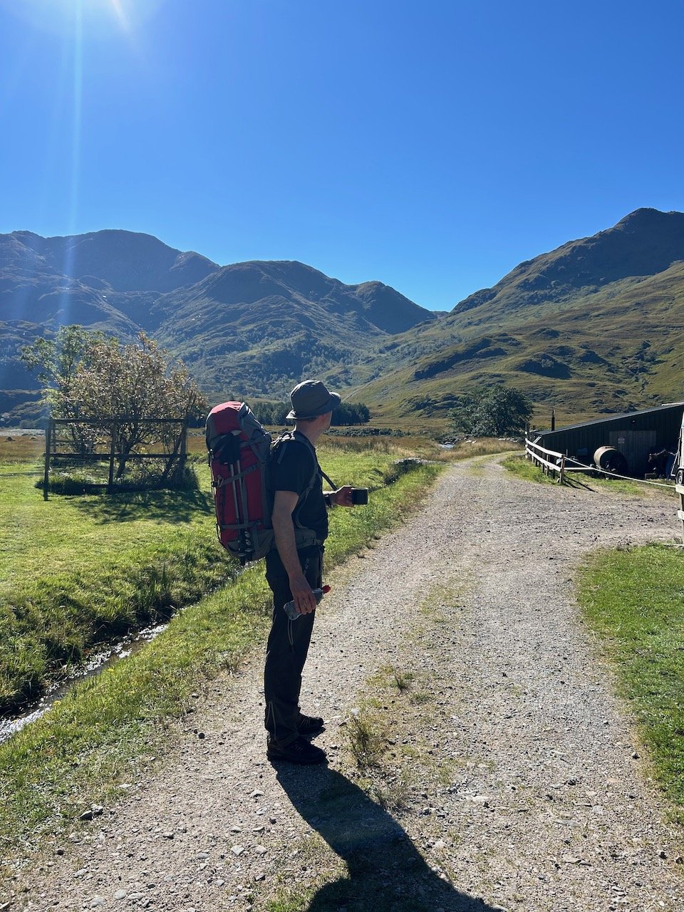
We quickly turn our attention to the stove and a brew. A few minutes later I was sat sipping coffee with my feet in the little stream that was slowly trickling past. This was an idyllic setting and we would have stayed longer if not for an army of midges and flies. Miles quickly donned his mozzie net and instantly looked smug, knowing I had decided not to bring one. It didn’t last long though as he quickly realised it is impossible to drink coffee whilst looking like a bee keeper. He opted for his coffee “on the go”.
We had agreed, during our stop, that we’d change plans and take the harder, longer path to Inverie. One that would see us walk an extra 7km in distance and climb up and over two Munroe mountains. I wish I could say this was after careful consideration of the options whilst looking at a map, but largely thanks to both us being attacked by flying insects it was not.
There was however good motivation for this. Ladhar Bheinn is considered one of Scotland’s most beautiful mountains and we had lucked out - being bathed in beautiful late summer sun. It felt too good an opportunity to pass up. And when were we likely to travel the length of the country to have this opportunity again…
What could go wrong?
We were navigating via the OS app, using a route Miles had found from their library of local routes. We crossed a bridge, turned right and headed straight for our target; the two big Munros. The views were incredible and distracting; so much so we were a bit blasé to the fact we almost immediately lost the route on Mile’s phone.
We were on a path, it just wasn’t the path. Miles was navigating and seemed confident so we carried on. The path we needed was close by, apparently. Little by little, the path became distinctly less path-like, until we were certain it was now more of a goat track. Another 100m further on, and I was convinced that even goats wouldn’t be stupid enough to come this way.
Cue neck high bracken and a very steep slope. I had totally lost sight of Miles and was now battling through jungle. I couldn’t see my feet and was navigating by the occasional shout or movement in the bushes.
Minutes later, I found Miles standing on a perfectly manicured path coming from our right.
We turned left, climbing the whole time, as entire sections of the path appeared, disappeared and reappeared, leading us to question who the hell had walked this route, and when. We were now climbing steeply and emerged into a beautiful valley set immediately below the ridge line we needed to reach. At best guess we still had another 600-700m to climb and the peaks still looked a long way away. It was a truly beautiful spot though, and would have made a brilliant camp site; everything was a lush green colour and there was a small river running from our left pouring off the steep sided slopes.
The path had disappeared again and we suddenly realised we needed to be on the opposite side of the river. This bit was at least straightforward as we made a makeshift bridge from huge boulders strewn across the valley floor. The same couldn’t be said for what came next.
Terra firma made way for a very steep and very long bog, the bracken returned and the path we needed had suddenly jumped several hundred metres to our right. It was extremely steep and the weight in our packs coupled with the sunshine made this an arduous 2 hour climb. Every time we thought we’d reached the saddle of the ridge, we’d summit to find a false peak, and another 100m of climbing. We were definitely in sense of humour crisis territory.
With the ordeal finally over, we collapsed on a large rock and unpicked the hell of the last few hours which included a comprehensive character assassination of the idiot who’d plotted this route who, by this point, we both agreed had never actually walked this route.
Once on the saddle, the going was a little easier but for the first time we became aware of the sun starting to drop in the sky.
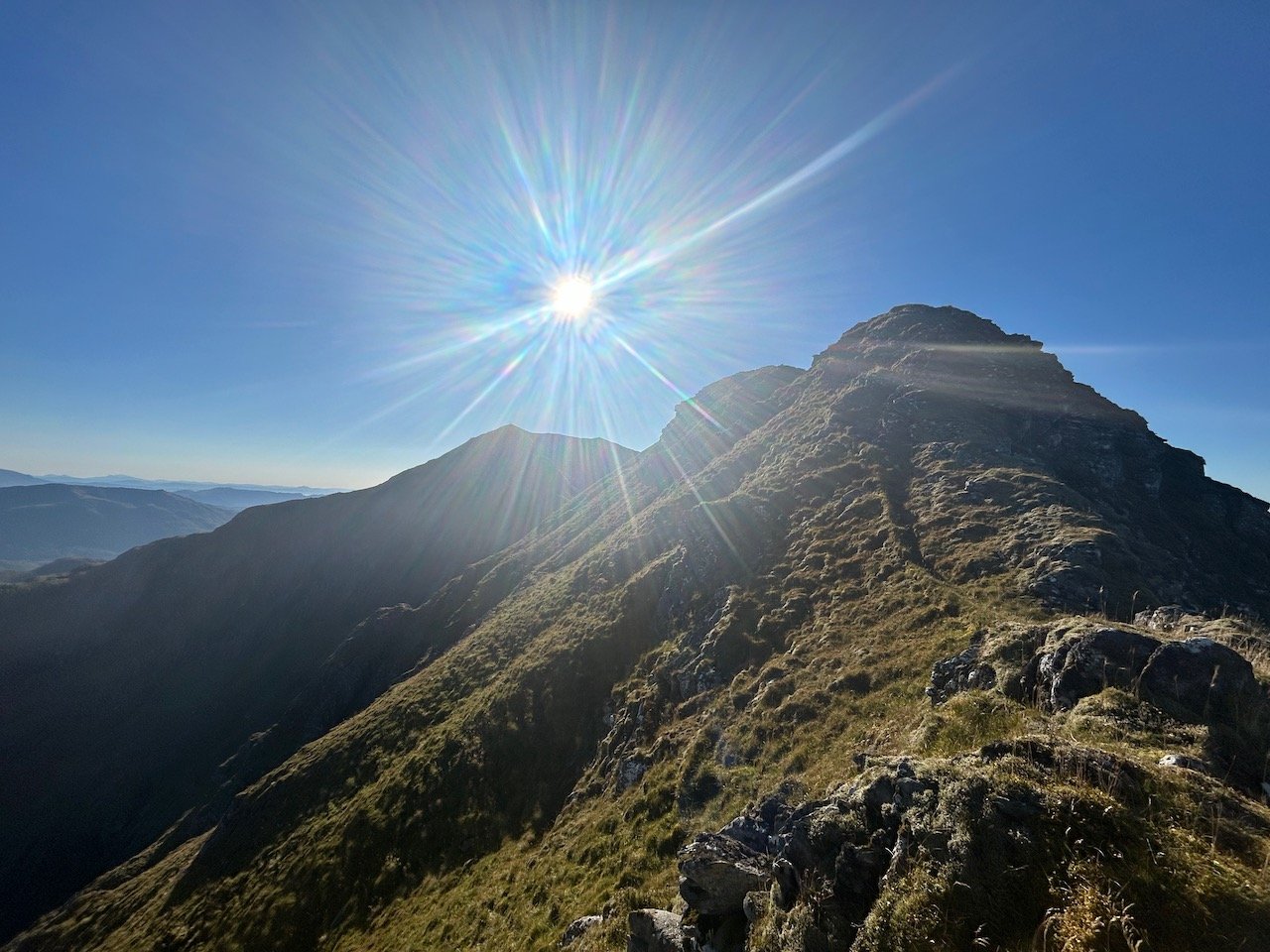
We could now see three peaks closely banded together. They formed a ridge which forked right towards Inverie and left to form an extended and impressive horseshoe ridge off to our left though we weren’t yet able to tell which was the highest peak.
We crossed a small gully that was cast in shadow and very wet underfoot. There was no path but a series of 40-50m short near-vertical scrambles that we needed to navigate. These proved quite fun but each time we scrambled to the top, we entered another gully and were faced with another 40-50m of scramble. On the upside, I found some wild blueberries growing on the upper slopes. Miles was quite clear we shouldn’t risk eating them.
Half an hour later we were standing at the foot of the last ascent before we hit the top of the ridge. A clear path was now visible zig zagging back and forth towards the peaks.
We were starting to feel it in our legs, but were both nervously eyeing the sun and its position above the ridge.
(We did at this point also make a “Plan B” which involved getting off the ridge, pitching the tents in one of any of the beautiful sheltered little gullies, rationing water and, yes, you guessed it, eating those wild blueberries.)
Walking the ridge was fun; there were drops either side of us, but they weren’t so steep that it jangled any nerves.
To our surprise, it didn’t take us long and less than an hour since we’d started scrambling, we’d made it to the summit.
What a view it was.
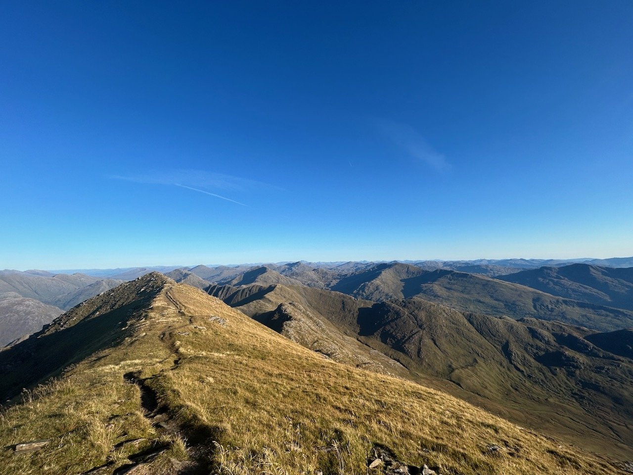
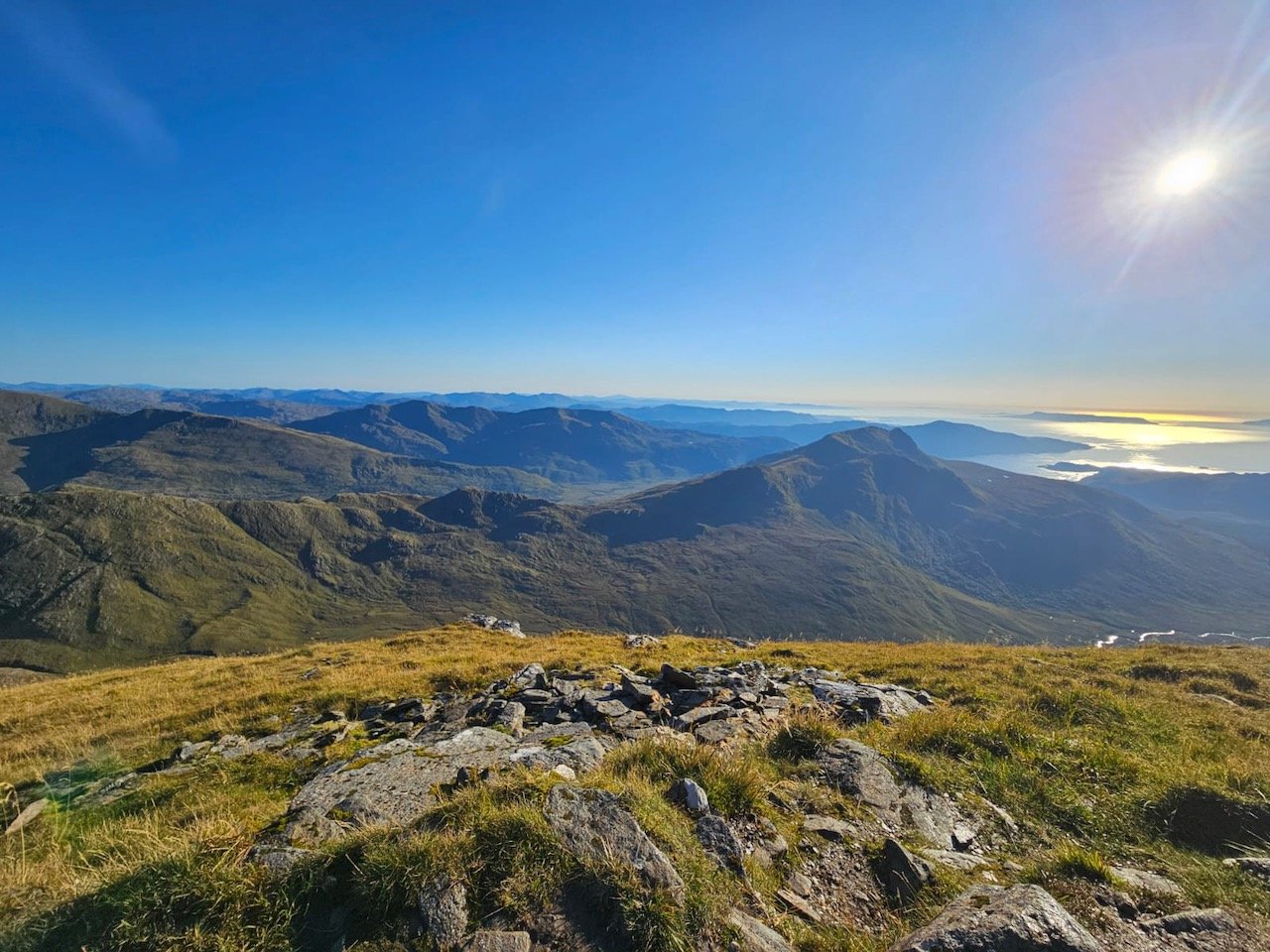
We didn’t just have the peak to ourselves, we couldn’t see another thing, save for the single sailing boat seemingly floating in Loch Nevis away to the west. The view was spectacular, without a cloud in the sky or a midge to bother us. It was also deadly quiet, the wind, for once, absent. Satisfaction of having made it to the top was tinged with slight unease as the coast still looked a long way away and we could only guess as to where Inverie itself lay. The sun, along with the temperature was dropping, and so we followed the ridge to the right, crested the final peak and started our descent.
I’ll be honest, navigating off the peak was pure guess work. Without a path, or a trusted route (we’d long since stopped looking at the phone route), we criss-crossed bog and bolder field, picking the route by what looked easiest to descend. We could see a path down in the valley that followed the river and disappeared into woodland and so we walked in that vague direction. Thankfully it worked and a little under an hour later we reached a bridge, crossed the river and picked up a 4 x 4 track.
For just a few minutes, it felt like we’d made it.
At this point, the sun had set and it was dusk. Our best guess was that we had 2km left to walk, but it was nearer 4km.
Our bags were feeling heavier than ever but we were spurred on by the fact the pub would be taking last orders shortly. It was the quickest we’d walked all day, the only hesitation came when we entered the dense woodland just behind Inverie. It was so dark it was hard to know where the edges of the track were and I had visions of finding ourselves at dawn having wondered off into deep into the woods. Alas, as we walked the final descent through the forest and saw the harbour lights start to twinkle through the trees, we were practically running.
We walked in to The Old Forge as last orders were called. This is what we’d come for. With live music playing, food, beer and an Auchentoshan were ordered, many hours after our table reservation had come and gone.
End note
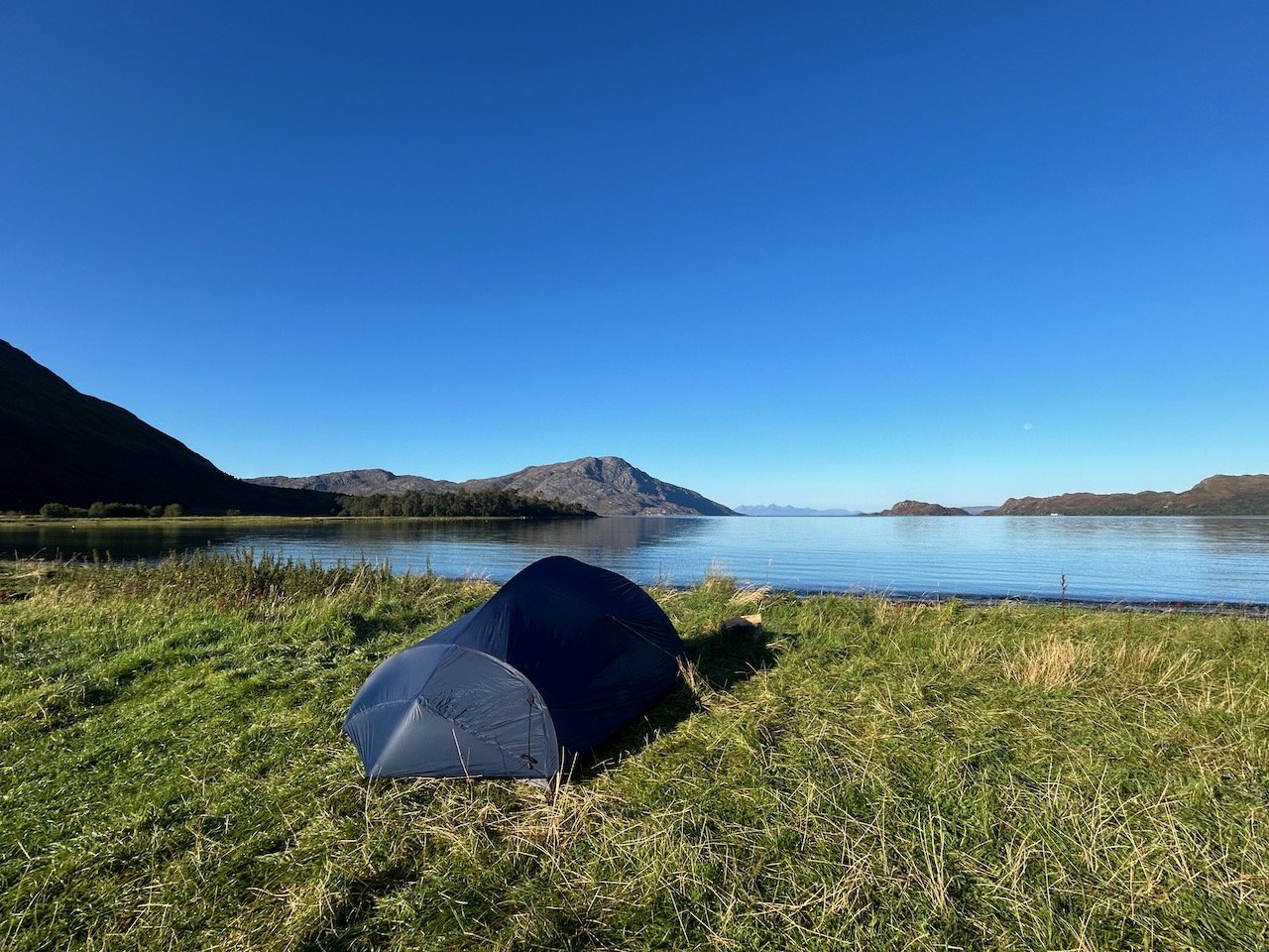
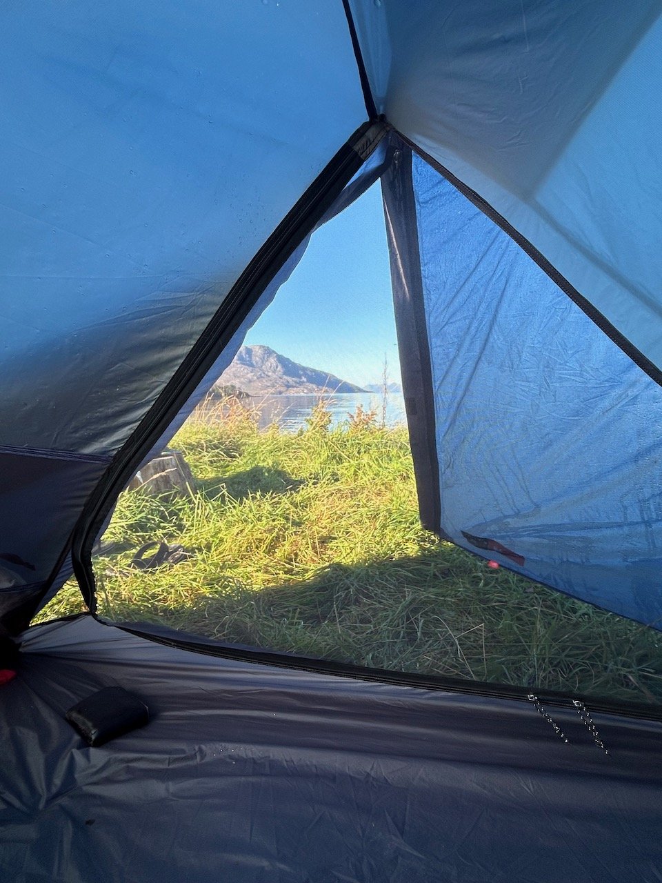
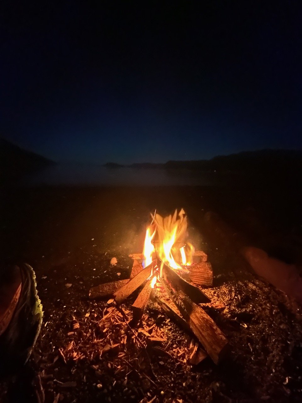
It’s near midnight and the fire is crackling, as we sit eating chocolate and talking about the epic adventure that Knoydart has given us. All we can hear are the waves gently rushing up the shingle beach towards us. We haven’t seen it yet but know we are camping in a very, very special place…