The Fan Dance one…

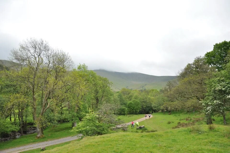
Brecon Beacons, May
Passing through the Welsh town of Brecon on a dank and dreary Saturday morning, ‘It’ hid its intimidating size in plain sight surrounded by mist and low lying cloud. These were, we told ourselves, entirely normal conditions for this part of the world, even in early summer.
We were driving along the valley floor, taking the small lane up and out of the town towards even more grey mirk. We knew we were getting closer as the nerves started to jangle.
At 886m, Pen-y-Fan is quite a foe. Surrounded by no less intimidating peaks - Corn Du (873m) and Cribyn (795m). The whole place feels big, making you feel like it could gobble you up and spit you out whenever it decides it’s peckish.
The Fan Dance race is a near 20 mile brute with a simple format. Ascend Pen-y-Fan 3 times via 3 different routes in as quick a time as possible.
The race organisers offered up two categories. 'Regular' category and 'Warrior' category. The latter mimicking the now infamous army training exercises that saw men cover every inch of mountainous terrain fully laden with 20kg backpacks and assault rifles.
'Regular' would do just fine for my comrade, Nick, and I.
There were 100 or so people on the start line. 20 or so had chosen to carry the equivalent of a 5 year old on their backs. Each 'Warrior' wore a look of stern, stoic determination. Everyone else just tried to stay warm by hopping on the spot.
Nick and I glanced in each other's direction. We both knew what the other was thinking - ‘For God’s sake, don’t go off too hard’. It would be a long day on the mountain.
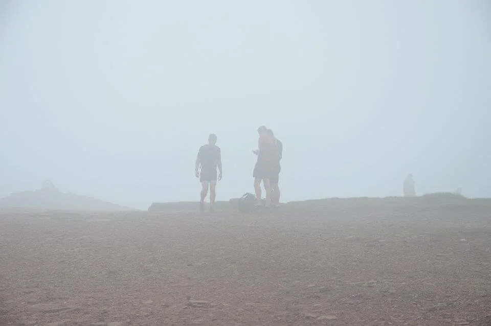
The count down started, the buzzer sounded and we ran straight into a cloud.
This particular cloud had some odd properties, requiring us to walk at a 45 degree angle to pass through it. There was to be no easing in to this race. The first handful of kilometres were all savagely uphill.
We reached the first check in point at the summit and whilst we were now crossing the plateau between Pen-y-Fan and Corn Du, our friend the cloud was omnipresent.
We descended the south facing slope, along the roman road to the reservoir at Torpentau. Here we were greeted by a friendly face and the boot of a car rammed with food and drink. We ate jelly babies and bananas whilst we assessed the conditions.
We'd dropped out of the cloud but as soon as we'd stopped moving, the wind chill started to bite.

We waved goodbye to the mobile cafe and started the lung busting ascent back to the top of Pen-y-Fan via Jacob's Ladder.
Now, I take issue with Jacob. Having done a number of these events, I've concluded that almost every major climb seems to involve running, walking or crawling up one of his damn ladders.
We were now near the top of the second ascent and we were breathing hard, simultaneously wanting to stop for rest and continue to keep warm. We couldn't afford our heart rate to drop. Nick pressed on, his metronomic gait serving as my guide across the plateau and to our second check point.
"Well done guys. It's straight along there until you hit the path" said the guy at the checkpoint, vaguely gesturing into yet more cloud, not unlike the air traffic controllers in the film Naked Gun.
Well, we carried on in that direction along with a handful of others. We were in the lead group and getting swept away with heady ideas of finishing this thing towards the front.
Only we never found the path.
Had we looked at the map we'd been given, we'd have realised that the path we were now on would continue for 10km or so until we started to descend to the northern edge of the Talybont reservoir. The only problem was the route didn't go anywhere near a reservoir or indeed Talybont.
Having run a couple of km without finding a path, one of the guys we were running with reached for his satellite phone. "I think this is against the rules" - said another. I'm not sure that really matters if we're soaked through and potentially miles off course" - replied the guy holding the GPS.
"Afraid it's a long way back" he said, objectifying the mistake.
We all trudged back the direction we'd come. All using interesting language to describe how misled we felt by the guy giving out the directions. We'd all expected to see some sort of route marker or marshal at the point of taking ‘the path’.
Anyway, it didn't matter. Nor did thinking about placing in the front group. That, along with our morale, had gone up in smoke, or more accurately had got lost in a very long cloud.
It's hard to predict how anyone will respond in the face of such a large and obvious error, particularly when you're already hurting, hungry and cold. Luckily, I’ve got form in this area having an indifferent relationship with maps and courses. Nick and I rallied, relying on a sense of injustice to pick up the pace and carry on to complete the final ascent of Pen-y-Fan.
But not before we found our path.
The final 2km were a fast downhill back to HQ. I remember flying down the uneven path, tussocks offering a potential ankle roll as every footstep landed.

My final memory of that race to the finish was a man, as wide as he was tall, carrying a toy rifle and (very real) burgen on his back. He appeared from the mist like a man possessed, clearly having saved something for the final stretch too.
We crossed the finish line completely spent, a full 5 hours 23 minutes after we'd started. We’d covered 32km (5 km further than we should have) and taken in just shy of 2000m of ascent. Despite the nav mishaps, we'd come 12th and 13th.
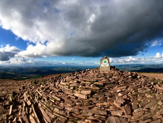
And we still couldn't see the Pen-y-Fan.
